EPRSC Towards Successful Suburban Town Centres Project
Go to Successful Suburban Town Centres Project website
download a one-page information sheet in .pdf format about the SSTC project
Project contacts: email: l.vaughan@ucl.ac.uk - telephone: +44 (0)20 3108 9042 - general enquiries: contact us
EPSRC reference: EP/D06595X/1
 Space Syntax measures Scale of analysis
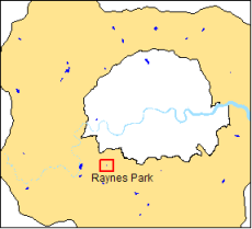
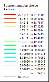
Choice is calculated by counting the number of times each segment falls on the shortest path between all pairs of segments within a selected distance-radius where shortest path refers to the path of least angular deviation or straightest route through the system. Global choice (radius n) visualises the shortest angular path between all pairs of segments in the system. It indicates vehicle through movement.
Red lines (high values) indicate greatest potential through movement.
blue lines (low values) indicate lowest potential through movement.
Click here for more information